 Tulum City Guide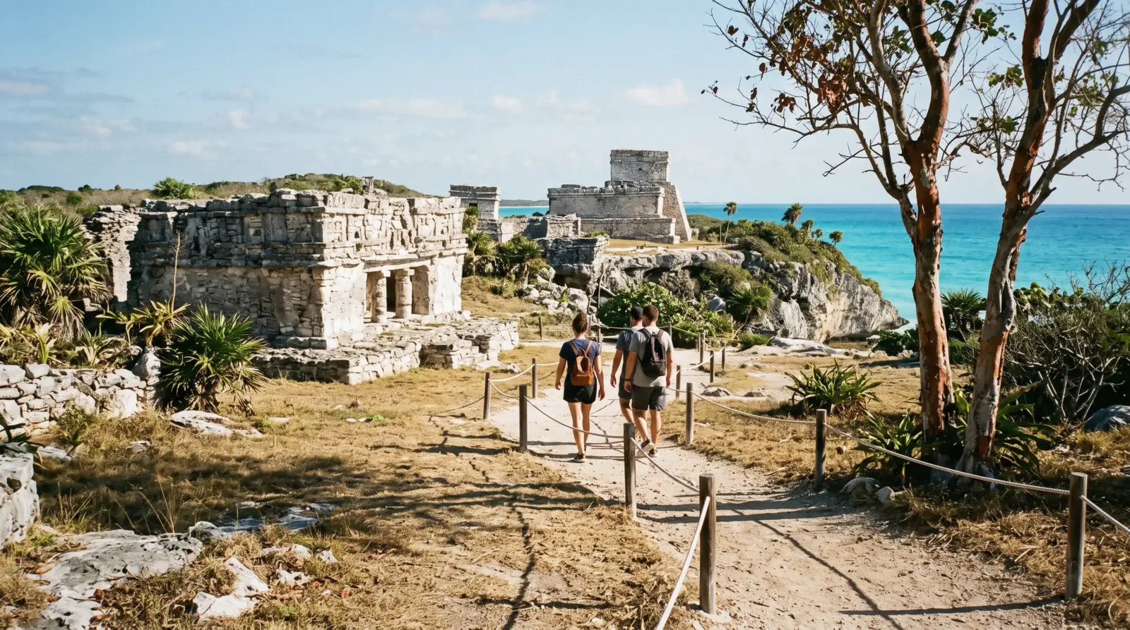
Tulum Ruins
The Tulum ruins are the only walled Maya city built on a Caribbean cliff, and the reason most people come to this stretch of coast at all. The site opens at 08:00, the last ticket goes at 15:30, and since the Parque del Jaguar took over the entrance a foreign adult pays one unified fee of MX$265 rather than the three separate charges most guides still print. The rest of the coast — the cenotes, the reserve and the beaches — is covered in our guide to things to do in Tulum.
Quick answer Hours, the fee, what to see, how long — in four lines
The Tulum ruins open daily 08:00–17:00 with last access at 15:30. A foreign adult pays MX$265 at the gate in one unified payment, a Mexican national or resident MX$80. The walled city takes about an hour to walk, ninety minutes if you stop at the cliff viewpoints, and there is almost no shade in it.
Key takeaways
- INAH publishes the fee as a costo unificado — MX$265 for foreign visitors, MX$80 for Mexicans and residents — and states it already covers the CONANP charge and the Parque del Jaguar fee; the ticket page sets that against the MX$511 an operator quotes
- There is no timed slot and no official online ticket: you pay at the gate, which is why a tour that bundles the entrance and two cenotes is the way most people avoid the queue and the taxi
- Three buildings carry the site — El Castillo on the cliff, the Temple of the Frescoes and the Temple of the Descending God — and the what-you-are-looking-at section explains what each was for
- Sundays are free for Mexican nationals and foreign residents, which makes Sunday morning the busiest hour of the week at the gate; the cenotes inland are the better Sunday plan
Key facts
Opening hours
| Daily, all year | 08:00–17:00 |
|---|---|
| Last access | —–15:30 |
| Parque del Jaguar around it | 08:00–19:00 |
Closed Open every day; INAH lists no weekly closure
Admission
- Adult
- MX$265 foreign adult (about $16), unified fee including the CONANP charge and the Parque del Jaguar management fee
- Reduced
- MX$80 Mexican nationals and foreign residents of Mexico (about $5)
- Free
- Sundays for Mexican nationals and foreign residents; INAH does not extend the Sunday rule to foreign visitors
Planning it
- Time needed
- Not stated by INAH; our routing: one hour for the walled city, ninety minutes with the cliff viewpoints
- Book ahead
- Optional — walk-up usually fine
- Address
- Carretera Federal 307, km 230, Tulum, Quintana Roo — main access through the CATVI entrance of Parque del Jaguar
Four ways through the gate, read from INAH's own page and from the GetYourGuide listings. INAH sells nothing online for this site, so the official row is a walk-up payment at the entrance — cash or card — and every other row is somebody driving you there with the entrance folded into the price.
One question decides which row is yours: are you paying for entry, or for the ride and the guide? INAH sells the entry at the window for MX$265, cash or card, and sells nothing online — everything below that row is transport and company.
| Option | Price | Includes | Cancel | Book |
|---|---|---|---|---|
| Official gate payment, INAH unified feeRight for anyone arriving by bicycle or colectivo — nothing is cheaper, and there is no online ticket to skip | MX$265 foreign adult (about $16); MX$80 Mexican or resident | Entry to the archaeological zone, the CONANP charge and the Parque del Jaguar fee | Not applicable — paid on the day | Official site |
| Guided ruins with hotel pickup and two cenotesThe cheapest way to add a driver and two cenotes to the same morning | From $26.09 | Guide, transport, swims at Mariposa and Chen-Ha | Free up to 24 hours before | Check Availability |
| Guided temples, coast museum and a reef snorkelOnly with INAH's figure in hand: this listing collects the gate fee separately, at its own number | From $116.70 | Guide, transport, snorkel gear — gate fee paid separately | Free up to 24 hours before | Check Availability |
| Private guided tour, 1.5 hours inside the wallsFor a group of four who want the pace, and the questions, to be their own | From $295 per group | Private van, certified guide, entrance fees included | Free up to 24 hours before | Check Availability |
The official row is a plain link to INAH and earns us nothing. Note the gap in row three: that operator's own listing prices Parque del Jaguar entry at MX$511 for foreign visitors and MX$315 for Mexicans, against INAH's MX$265 — both figures read, and both are on the ticket page.
Guided visits to the Tulum ruins, compared
What a guide buys you here is context, not queue-skipping — there is rarely a long queue, and no timed entry to jump. Prices in US dollars as listed by GetYourGuide.
 from $26.09
Riviera Maya: Tulum Ruins, Mariposa & Chen-Ha Half-Day Tour
The cheapest way to pair the ruins with two cenote swims — hotel pickup, a guided walk, then Mariposa and Chen-Ha. Biggest review count here.
Check Availability from $116.70
Tulum: Mayan Ruins, Snorkeling, and Jaguar Park Tour
Guided temples, the coast museum and a reef snorkel in 4.5 hours. The operator states plainly that park entry is paid at the gate.
Check Availability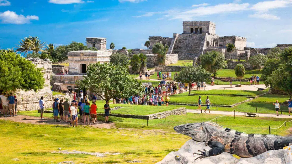 from $295
Private Guided Tulum Ruins For History Lovers
Private van from your hotel, 1.5 hours with a certified guide inside the walls, then an hour alone. The INAH ticket is included, so nobody queues.
Check Availability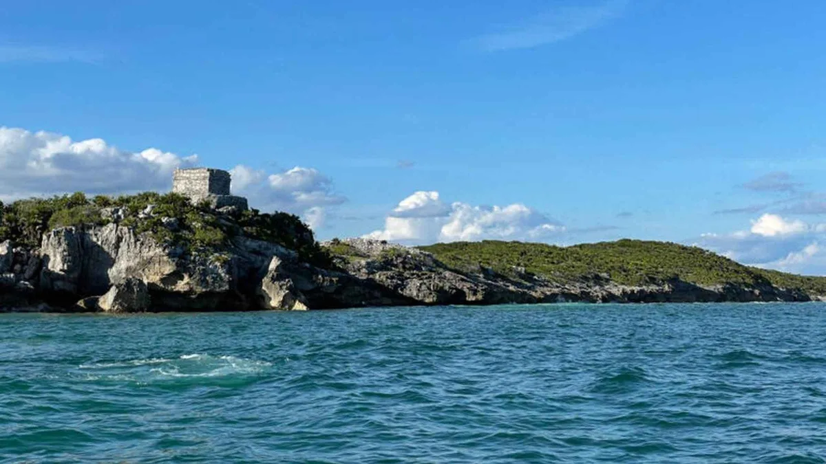 from $175
Tulum: Ruins by Boat, Swim with Turtles & Cenote Tour
The only way to see the cliff from the water: a boat along the ruins coast, then a turtle snorkel, a cenote and lunch.
Check Availability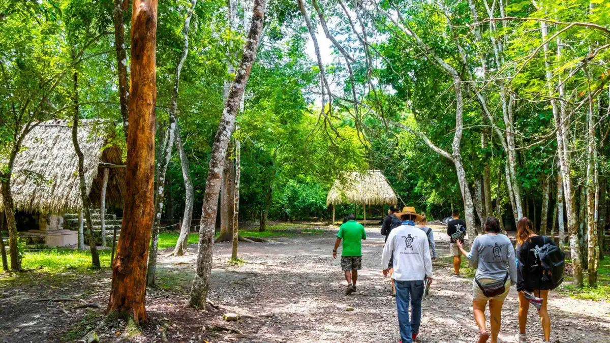 from $45
Riviera Maya: Tulum, Coba & Cenote Tour: Transport & buffet
Two archaeological zones and a cenote swim in one day with hotel pickup and a buffet — the cheapest full day on this page.
Check AvailabilityPrices, ratings and details are the platform's own. Dollar figures are the listed prices. The platform bills in your account's currency.
What you are looking at: a walled port called Zama
Tulum is late. Most of the Maya cities people have heard of were already abandoned when this one was at its height, between the 13th and 15th centuries, and it was still occupied for about seventy years after the Spanish arrived.
The city served as the sea port for Cobá, the far larger inland capital 45 minutes west, and it traded obsidian, jade, salt and cotton up and down the coast in canoes. Its likely Maya name was Zama, City of Dawn, because the whole site faces the sunrise. Tulúm — the name that stuck — is the Yucatec word for wall or fence, which tells you what impressed the people who came later.
The first European mention is Juan Díaz's, from Juan de Grijalva's expedition of 1518. The description that made it famous came much later: John Lloyd Stephens and Frederick Catherwood published it in 1843, arriving by sea and seeing El Castillo first, exactly as the traders had. The city itself was abandoned by the end of the 16th century.
The wall, and why it exists
The landward sides are closed by a wall that averages three to five metres high and is about 8 m thick, running 400 m along the side parallel to the sea and about 170 m down each flank. There are five gateways through it, and small structures at the southwest and northwest corners that read as watchtowers. Building that took a great deal of labour for a city this size, which is the clearest thing the site says about the century it was built in.
The seaward side needed no wall: the cliffs do that job, about 12 metres of them. The one break is a small cove with a sand beach, and that cove is the reason the city is where it is — it is where the trading canoes came in. A small cenote inside the northern wall supplied fresh water.
Why the city was abandoned, as far as anyone knows
There is no dramatic answer, and the site panels do not offer one. Tulum was still occupied about seventy years after the first Spanish ships passed, which is longer than most Maya cities on this coast managed, and the collapse that followed tracks the collapse of the trade the city lived on — coastal canoe routes that stopped paying once the Spanish controlled the ports at either end — along with the epidemics that ran ahead of the colonists everywhere in the Americas. By the end of the 16th century the city was empty.
What happened afterwards is more visible on the ground than the abandonment itself. The buildings stayed standing because nobody quarried them: the coast was empty of towns until the 20th century, and the walls kept the sand and the forest at a distance. That is the real reason a small, late, provincial city is one of the best-preserved Maya sites anywhere — it was left alone for four hundred years.
Zama In Eight Dates
The dates the agencies and the early accounts put a number on, from the earliest inscription here to the fee at the window this year. Anything before the Spanish period is approximate to within a generation.
-
564 CE
The earliest date carved on the site
INAH records the earliest documented date at Tulum at the Temple of the Initial Series, southwest of El Castillo. The walled city you walk through is seven centuries younger.
-
13th–15th centuries
The walled port at its height
Most Maya cities people have heard of were already abandoned by the time this one peaked. It was the sea port for Cobá, trading obsidian, jade, salt and cotton by canoe.
-
Before 1500
The wall goes up
Three to five metres high and about eight thick, with five gateways and two watchtowers — the count INAH publishes for the site.
-
1518
The first European mention
Juan Díaz, sailing with Juan de Grijalva's expedition, describes a city on the cliff. The Spanish saw it exactly as the traders did, from the water.
-
16th century
Sixteenth-century sources call it Zamá
INAH's zone page states that the sources of that century name the site Zamá — Yucatec for morning or dawn — and that Tulum, meaning wall, is the recent name.
-
By 1600
Abandoned
The city held on about seventy years after the first Spanish ships passed, then emptied as the canoe trade collapsed and epidemics ran ahead of the colonists.
-
1843
Stephens and Catherwood publish
Stephens and Catherwood publish the description and the drawings that made the site famous, having arrived by sea and seen El Castillo first.
-
Now
One gate, one unified fee
INAH publishes a single COSTOS UNIFICADOS tariff, stating that it already covers the CONANP charge and the Grupo Mundo Maya fee — one payment at the CATVI window instead of three.
Sources: INAH's Zona Arqueológica de Tulum page, re-read for this update, which carries the 564 CE inscription, the Zamá naming, the wall's gateways and watchtowers and the unified tariff; the 1518 and 1843 accounts are Juan Díaz's and Stephens and Catherwood's own.
The buildings, in the order the path takes them
The walking route runs anticlockwise from the northwest gate, and three structures carry the visit. You cannot enter any of them — the interiors have been closed for years — so this is a site you read from the outside.
El Castillo
The building on the cliff edge, and the one in every photograph. It sits on the highest point of the site with the sea directly behind it, and it worked as a lighthouse as much as a temple: two small windows in the upper room line up so that a canoe holding both lights in view is running the one safe gap through the reef. Everything else about the reef here is hostile, which is precisely the point.
Temple of the Frescoes
The most rewarding building on the site if you slow down. It has a lower gallery and a smaller upper one, and it was used to track the movement of the sun. Niched figures of the diving god decorate the facade, and a mural survives on the eastern wall in a style that came from highland Mexico.
It is the closest thing here to what the city's own painters were doing.
Temple of the Descending God
Small, and named for the stucco figure above its doorway — a body diving head-first, arms back, which appears again and again across the site. Whether the figure is the setting sun, the bee god or Venus is not settled; the museum panels at the entrance say as much rather than picking one.
What is not here
There is no pyramid you can climb at Tulum and no ball court of any size. If climbing is what you came to Mexico for, that is at Cobá, where INAH still publishes access to the Nohoch Mul pyramid between 08:00 and 15:30 in groups of fifteen.
Hours, heat and the quiet hour
INAH publishes the archaeological zone as open daily from 08:00 to 17:00, with the last access at 15:30. Parque del Jaguar, the park the entrance now sits inside, opens at 08:00, takes its last visitors at 17:00 and closes at 19:00.
Take the earlier of those two numbers as your deadline: if you arrive at 15:20 you will be sold a ticket and then have ninety minutes in a site that empties at 17:00. The overlap matters the other way too — the park stays open two hours after the ruins close, which is why the trails and the viewpoints are the sensible end of an afternoon here.
The heat is the real constraint. There is no shade inside the walls beyond a few gumbo-limbo trees, the limestone throws the sun back at you, and average highs run 26 °C in January to 30 °C in July and August. The two comfortable windows are the first hour after opening and the last hour before last access. The middle of the day is when the coaches from Cancún and Playa del Carmen unload, which is our own reading of the pattern — INAH publishes no visitor count for the site, monthly or otherwise.
| When | What it is like | Why |
|---|---|---|
| 08:00–09:30 | Coolest and emptiest | The gate has just opened and the coach groups are still on Highway 307 |
| 10:00–14:00 | Hottest and busiest | Day trips from Cancún, Playa del Carmen and the cruise port land in this window |
| 14:00–15:30 | Quiet again, still hot | Last access is 15:30, so the groups have left and the light starts to soften |
| Sunday morning | Busiest morning of the week | INAH entry is free that day for Mexican nationals and foreign residents |
How Much Time To Give The Tulum Ruins
INAH publishes no visiting time for this zone, so these are our three routings measured against the hours it does publish: open 08:00, last access 15:30, gate closed at 17:00, with the park around it open until 19:00. The walk from the ticket window to the first building takes fifteen to twenty minutes and is inside every figure below.
The site is small — a walled rectangle you can cross in ten minutes — so the difference between the routings is not the buildings but the cliff, the park and how long you are prepared to stand in the sun.
| Routing | Inside the walls | Door to door from Tulum town | What you skip |
|---|---|---|---|
| The walled city, briskly | 1 h | About 2 h by bicycle or colectivo | The cliff viewpoints and every trail in Parque del Jaguar |
| The full circuit with the viewpoints | 1.5 h | About 2.5–3 h | Nothing on this page; this is our own routing |
| With a guided day | 75 minutes guided, or 8 hours with two cenotes | 8–8.5 h on the longer one | Your own pace, and the empty hour between 08:00 and 09:30 unless the departure is early |
Whichever you take, the constraint is the heat rather than the buildings. There is no shade inside the walls beyond a few gumbo-limbo trees and the limestone throws the sun back at you, so the honest advice is to be at the window at 08:00 and out again before the coaches land. If you arrive late instead, note that the park stays open two hours after the zone closes: the trails and the viewpoints are the sensible end of an afternoon here, not the start of one.
Getting there, and which gate you actually use
The site is four kilometres north of Tulum town on Highway 307, and the entrance you use is not the one on old maps: access now runs through the CATVI entrance of Parque del Jaguar, with the car park and the ticket windows there.
From the town, a colectivo heading north on the highway drops you at the entrance road in about ten minutes; a bicycle takes twenty on the cycle path and is what most people staying in town do. Taxis have no published tariff in Tulum, so agree the fare before you get in. From the beach road it is a longer ride than it looks on the map, because you have to come back inland to the highway first.
From the entrance to the first building is a walk of roughly fifteen to twenty minutes along a paved path — allow for it when you are working back from the 15:30 cut-off. Bring pesos: the gate takes cards, but the ATMs at the entrance are the tourist kind. Drones are not allowed anywhere in the park, and neither is alcohol or single-use plastic.
What the park does and does not allow
Parque del Jaguar publishes its rules on its own site, and the gate enforces them: the wristband stays visible, you keep to the marked trails, drones are not flown anywhere in the park, loudspeakers are not played, alcohol is not drunk and single-use plastics are not carried in. Only assistance animals are admitted. The beaches inside the park are turtle nesting ground, and the signs asking you to stay off marked sections are not decorative.
What to bring is short: pesos, water in a refillable bottle, a hat, and shoes you can walk uneven limestone in. Biodegradable sunscreen is the norm on this coast because of the reef and the cenotes, and several operators list it in their own what-to-bring notes. There is shade, food and a bathroom block at the entrance area, and none of the three inside the walls.
The beach below the walls
The cove inside the site is the one gap in twelve metres of cliff, and it is the reason the city exists.
Whether the wooden stairs down to it are open is decided at the gate on the day — sea state, nesting season and works have all closed them in recent years, and INAH publishes nothing about it in advance. Ask when you buy your ticket, and carry swimwear only if the answer is yes.
The public alternative is a short walk south. Playa Paraíso and the public beaches sit under the same cliff line, cost nothing and have no minimum spend, which is not true of the beach clubs further down the road.
Dos And Don'ts At The Tulum Ruins
The short version of everything above, for the morning you go.
Do
- Be at the CATVI window at 08:00 — the first ninety minutes are the cool, empty ones, and the coaches land from about 10:00
- Carry pesos as well as a card: the gate takes both, but the machines at the entrance are the tourist kind — what each gate takes
- Allow fifteen to twenty minutes on foot from the window to the first building when you work back from the 15:30 cut-off
- Ask at the gate whether the stairs to the cove are open that day; sea state and nesting close them without notice
- Bring water in a refillable bottle, a hat and shoes for uneven limestone — the walled city has no shade and no bathroom
- Finish in the park rather than the town: Parque del Jaguar stays open until 19:00 after the zone closes at 17:00
Don't
- Don't plan to climb anything — no structure here is open and the interiors have been closed for years; the pyramid you can still climb is at Cobá
- Don't arrive after 15:00 expecting a full visit: the ticket window shuts at 15:30 and the zone empties at 17:00
- Don't accept MX$511 as the entrance fee — INAH publishes MX$265 as the unified figure and says it already covers the park charges (the arithmetic)
- Don't bring a drone, alcohol or single-use plastic; the park publishes the ban and the gate enforces it
- Don't stack the ruins onto the end of a beach day — the hours run the wrong way, and the walk in eats twenty minutes of what is left
- Don't count on a Sunday morning being quiet: entry is free that day for nationals and residents
Tulum ruins map: the gate, the buildings and what is nearby
The CATVI entrance, the walled city on the cliff, and the three places within twenty minutes that most people pair with it.
Five Things Most Visitors Do Not Know About The Tulum Ruins
Facts that change how the site reads, each with where it comes from.
- The oldest date here is seven centuries older than the city. INAH records 564 CE at the Temple of the Initial Series as the earliest documented date at Tulum, while the walled port you walk through belongs to the 13th to 15th centuries. (INAH, Zona Arqueológica de Tulum) - Its own name was Zamá, not Tulum. Sixteenth-century sources call the site Zamá, Yucatec for morning or dawn, because the whole city faces the sunrise; Tulum, meaning wall or palisade, is the recent name and describes what impressed later arrivals. (INAH, Zona Arqueológica de Tulum) - El Castillo worked as a lighthouse. Two small windows in the upper room line up so that a canoe holding both lights in view is running the one safe gap through the reef — which is the reason a trading port sits on the most hostile stretch of that coast.
(Argued in full in the buildings above) - You are paying one fee where three bodies used to collect. INAH's tariff table is headed COSTOS UNIFICADOS and states the price includes the CONANP charge and the Grupo Mundo Maya fee; one operator's listing still prices the park entry at MX$511. (INAH; the GetYourGuide listing) - The park around the ruins is nearly 3,000 hectares. Parque del Jaguar covers about 2,913 hectares with roughly 12 km of jungle trails and viewpoints, and it is open two hours later than the archaeological zone inside it. (Grupo Mundo Maya, parquedeljaguar.grupomundomaya.com) Because the ruins and the jungle around them reward different kinds of exploring, the best tours in Tulum pair guided visits to the archaeological zone with time on the park trails.
Eating At The Gate
There is food at the entrance area and none at all inside the walls, which is the part people plan around badly.
The entrance area at CATVI has shade, a bathroom block and places to eat; the archaeological zone beyond it has none of the three, and the circuit takes an hour or more with no cover. Carry water in a refillable bottle — single-use plastic is banned in the park and the ban is enforced at the gate — and eat before you go in rather than planning a meal for the far end.
The better meal is four kilometres south in the town, where the taquerías cost a fraction of the beach road: where to eat in Tulum names the streets. If you are cycling back from the gate at midday, that is the natural stop, and it is the same ride you would make anyway.
Next stop from the Tulum ruins
Walking and driving minutes are our own estimates from the GPS distances.
Tulum beaches
The public sand under the same cliff line, free and without a minimum spend. Playa Paraíso and the public beaches are the natural second half of a ruins morning, and the reef offshore is the one a two-hour reef snorkel works.
15 min walk southCenote Calavera
Three holes in a limestone roof on the Cobá road, and the fastest way to cool down after the walls. Cenote Calavera is a jump-in cenote rather than a swim-around one; the cenote index sets out which is which.
10 min by car, inlandCobá
The inland capital this port served, at MX$210 for a foreign adult. Forest causeways, shade, and a pyramid INAH still publishes climbing hours for — the contrast with Cobá is the best argument for giving the ruins only a morning.
45 min by car, westTulum ruins: the questions people ask at the gate
Are the Tulum ruins worth visiting?
For the setting, yes — no other Maya city stands on a Caribbean cliff, and an hour inside the walls at 08:00 is one of the best hours on this coast. For architecture alone, they are modest: the buildings are small, you cannot go inside them, and Cobá is the bigger site. The honest version is that they are worth an early morning and not worth a midday queue in July.
Are the Tulum ruins Mayan or Aztec?
Maya. The Aztec empire was 1,300 kilometres west, in the Valley of Mexico, and never held this coast. Tulum was a Maya walled port trading up and down the Caribbean for Cobá, at its height between the 13th and 15th centuries.
Is Chichén Itzá or Tulum better?
They are not the same kind of visit. Chichén Itzá is much larger, far more important archaeologically, and two and a half hours away by road — the day trip from Tulum runs twelve hours door to door. Tulum is small, spectacular in position, and an hour from breakfast. If you have one free morning, come here; if you have a whole day and want the bigger site, go there.
How long do you need at the Tulum ruins?
INAH states no visiting time. Our routing is an hour for the walled city and ninety minutes if you stop at the cliff viewpoints, plus fifteen to twenty minutes' walk each way from the CATVI entrance. Add the trails of Parque del Jaguar and you can fill a morning; most people do not.
Can you swim at the Tulum ruins?
Sometimes. The cove inside the site has a sand beach and wooden stairs, and whether they are open is decided at the gate that day — sea state, turtle nesting and works have all closed them. The reliable swim is a short walk south at the public beaches, or inland at the cenotes.
Do you need a guide at the Tulum ruins?
No, and the site has signage in Spanish and English. A guide is worth it if you want the trade-route and diving-god material that the panels only gesture at — the private guided walk covers it in ninety minutes, and the shared tour with two cenotes is the cheaper way to hear the same thing.
Where the ruins fit in a Tulum day
The site's own hours make the shape of the day for you.
Gate at 08:00, out by 09:30, and you have the entire cool part of the morning left. The two sensible continuations are inland to a cenote, which is 24 °C water and full shade, or ten minutes south to the beaches while the sea is still flat. What does not work is stacking the ruins onto the end of a beach day: last access is 15:30 and the walk in eats twenty minutes of it.
If you have one day in Tulum, the fee table on the homepage sets the ruins against everything else you would be paying for. If you have three, the ruins are the morning of day one and Sian Ka'an is the whole of day two.
The Tulum ruins on film, before you pay the gate
Two full walk-throughs of the site and one guide to the visit itself, so you can see the scale of the buildings and the state of the path before you decide how long to give it.
Full Guided Walking Tour of Tulum Mayan Ruins
The whole walking route with a guide's commentary, building by building.
Video: Captain TomTulum Ruins Guide for Getting the Most of Your Visit
How the entrance, the walk in and the timing work in practice.
Video: EverythingPlayaDelCarmen.comTulum Mayan Ruins Walk — Full Walking Tour
An unnarrated walk through the site, useful for judging shade and crowds.
Video: Free To WanderVideos load from YouTube only when you press play.
Prices, hours and terms are set by the venue or operator and confirmed at checkout.
We may earn a commission if you book through one of our links, at no extra cost to you. Full affiliate disclosure